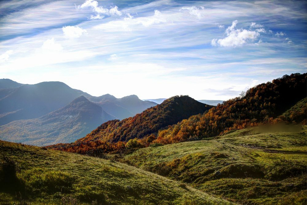
Altiaghaj National Park was established in August 2004. The National Park is located in Khizi and Siyazan regions. It was created in an area of 11 035 hectares on the base of Altiaghaj State Natural Reserve and adjacent state owned forest lands.The main objective in the creation of the National Park is to ensure the conservation of basic components of the natural landscape of the southeastern slopes of the Greater Caucasus, the rehabilitation of flora and fauna species, the implementation of environmental education along with tourism and recreation.Brown forest mountainous, humic carbon forest mountainous, steppe grassland mountainous and other types of terrains are found in the National Park’s area. The climate here is moderately warm and dry both in winter and summer.The largest river in the area is Atachay. Taking its origin at a height of 1870 meters in Dubrar Mountain the Atachay river flows into the Caspian Sea. The major part of the park is composed of areas covered with forests.The main tree species are Caucasian oak, Caucasian hornbeam, oriental beech, ash and birch. Shrub species occurring in the area include hawthorn, dog-rose and blackberry.Roe deer, brown bear, wild boar, lynx, raccoon, hair, fox, squirrel, wolf of mammals and pheasant, partridge, eagle, thrush, goatsucker, ring-dove of birds are found in the National Park.
Altiaghaj region excursion objects:
The house-museum of poet-lyrics Mikail Mushvig in area of Tezekend settlement
Ruins of a small fortress “Giz Galasi” – presumably, a medieval fortress “Khayzan” of Albanian
Original architecture of inhabited houses of South-Russian settlers of the period of the middle of XIX century in Alti-Agaj settlement
Architecture of inhabited houses-huts of the South-Ukrainian countrymen of second half XIX century in Gyzyl-Gazma settlement
Ruins of small Russian settlement of the middle of XIX century – Chistiy Kluch, in vicinities of Alti-Agaj settlement
Hunting zone (the Caucasian-noble deer) at Kars / Hirs settlement in Tykhchay river head
The rests of small settlements of local residents of tats-muslims – “Dagli”
Ruins of Hirek, Pembe, Shurakend, Deller, and Garabulag in Garabulagchay river head
Ruins of Gariban and Angelan in Tykhchay river head
Ruins of Achagi and Yukhari Dizavar in Dizavarchay river head
Ruins of Uka and Karmili in Karmilichay river head
Ruins of Angelan, Emizder / Ambizler, Radjilu, Gasimkend and Tudar in Angelanchay / Tudarchay river heads
Ruins of Yukhari Kesh
Ruins of Yukhari Zarat in Halchay riverheads on Varafte Ridge
Ruins of Yukhari Findigan north-west of Galatepe mountain (851 m.) in area of Gaynardja mountain plateau
Group of lakes (6 lakes) of mud-volcanic origin in Gaynardja tract
Chain of lakes of a mud-volcanic origin (15 lakes) / the largest are: Gannigyol, Fatmabil and Nourdaranly
– Ruins of a medieval Muslim monastery of sufists awards “Nakshbandiyya” – Khanagya in riverheads of Pirallahi ,Gadissa to the north from Kimchi mountain (1026 m.) on the Main Caucasian Ridge.